¡Llegaron los Días Planeta con hasta 70% Dto!  ¡Imperdible!

Enviar a
Santiago, Región Metropolitana
0
  • argentina
  • chile
  • colombia
  • españa
  • méxico
  • perú
  • estados unidos
  • internacional

Selecciona tu país

América

Europa

Resto del mundo

portada Northern Cyprus / Kypros Hiking & Walking Map 1: 75000 Complete Topographic Map Atlas Trekking Paths & Trails Mediterranean World: Trails, Hikes & Wal (en Inglés)
Formato
Libro Físico
Editorial
Idioma
Inglés
N° páginas
40
Encuadernación
Tapa Blanda
Dimensiones
27.9x21.6x0.3 cm
Peso
0.15 kg.
ISBN13
9781719199643

Northern Cyprus / Kypros Hiking & Walking Map 1: 75000 Complete Topographic Map Atlas Trekking Paths & Trails Mediterranean World: Trails, Hikes & Wal (en Inglés)

Sergio Mazitto (Autor) · Createspace · Tapa Blanda

Northern Cyprus / Kypros Hiking & Walking Map 1: 75000 Complete Topographic Map Atlas Trekking Paths & Trails Mediterranean World: Trails, Hikes & Wal (en Inglés) - Mazitto, Sergio

Libro Nuevo Importado
Envío: 16 a 21 días háb.
$ 50.180$ 27.600
-45%
Costos de importación incluídos en el precio ✅
Libro Nuevo

Quedan más de 100 unidades

$ 27.600
Llega entre el 06 Oct y el 14 Oct a Santiago, Región Metropolitana. Seleccionar ubicación

Reseña del libro "Northern Cyprus / Kypros Hiking & Walking Map 1: 75000 Complete Topographic Map Atlas Trekking Paths & Trails Mediterranean World: Trails, Hikes & Wal (en Inglés)"

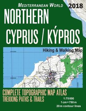
Updated edition. Detailed topographic map 1:75.000 for hiking and trekking, printed as an atlas book (with overlapping pages). Most geographic names are given in both English and the language of the local population (Greek or Turkish).Complete map of the Northern Cyprus covering great walks and wonderful hiking trails in the area.20 meter contour lines, road network, trails & paths, transportation, food, campsites, shelters, guest houses & hotels.Mercator projection with both UTM and WGS84 coordinate grids.The map scale of 1:75000 (1 cm = 750 meters) provides a wealth of detail while keeping low the weight of the atlas itself. The large page format of 8.5x11in minimizes page count and along with an overlapping map design allows for comfortable navigation. The details included in the topographic maps of this atlas were specifically selected to be useful for trekkers, hikers and walkers of all interests, and make it easy to plan and enjoy both short excursions and hikes as well as long multi-day adventures along the main marked routes and/or adjacent trails and paths, which are also shown on the maps.With this ultralight atlas you will always have a detailed, reliable, information-rich, battery-independent, shatter-proof map for your adventure.

Opiniones del libro

Preguntas frecuentes sobre el libro

Todos los libros de nuestro catálogo son Originales.
El libro está escrito en Inglés.
La encuadernación de esta edición es Tapa Blanda.

Preguntas y respuestas sobre el libro

¿Tienes una pregunta sobre el libro? Inicia sesión para poder agregar tu propia pregunta.

Opiniones sobre Buscalibre

Ver más opiniones de clientes