Compartir
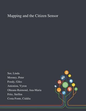
Mapping and the Citizen Sensor (en Inglés)
Linda See
(Autor)
·
Peter Mooney
(Autor)
·
Giles Foody
(Autor)
·
Saint Philip Street Press
· Tapa Blanda
Mapping and the Citizen Sensor (en Inglés) - See, Linda ; Mooney, Peter ; Foody, Giles
$ 64.480
$ 89.550
Ahorras: $ 25.070
Elige la lista en la que quieres agregar tu producto o crea una nueva lista
✓ Producto agregado correctamente a la lista de deseos.
Ir a Mis Listas
Origen: Estados Unidos
(Costos de importación incluídos en el precio)
Se enviará desde nuestra bodega entre el
Miércoles 31 de Julio y el
Lunes 12 de Agosto.
Lo recibirás en cualquier lugar de Chile entre 1 y 3 días hábiles luego del envío.
Reseña del libro "Mapping and the Citizen Sensor (en Inglés)"
Maps are a fundamental resource in a diverse array of applications ranging from everyday activities, such as route planning through the legal demarcation of space to scientific studies, such as those seeking to understand biodiversity and inform the design of nature reserves for species conservation. For a map to have value, it should provide an accurate and timely representation of the phenomenon depicted and this can be a challenge in a dynamic world. Fortunately, mapping activities have benefitted greatly from recent advances in geoinformation technologies. Satellite remote sensing, for example, now offers unparalleled data acquisition and authoritative mapping agencies have developed systems for the routine production of maps in accordance with strict standards. Until recently, much mapping activity was in the exclusive realm of authoritative agencies but technological development has also allowed the rise of the amateur mapping community. The proliferation of inexpensive and highly mobile and location aware devices together with Web 2.0 technology have fostered the emergence of the citizen as a source of data. Mapping presently benefits from vast amounts of spatial data as well as people able to provide observations of geographic phenomena, which can inform map production, revision and evaluation. The great potential of these developments is, however, often limited by concerns. The latter span issues from the nature of the citizens through the way data are collected and shared to the quality and trustworthiness of the data. This book reports on some of the key issues connected with the use of citizen sensors in mapping. It arises from a European Co-operation in Science and Technology (COST) Action, which explored issues linked to topics ranging from citizen motivation, data acquisition, data quality and the use of citizen derived data in the production of maps that rival, and sometimes surpass, maps arising from authoritative agencies. This work was published by Saint Philip Street Press pursuant to a Creative Commons license permitting commercial use. All rights not granted by the work's license are retained by the author or authors.
- 0% (0)
- 0% (0)
- 0% (0)
- 0% (0)
- 0% (0)
Todos los libros de nuestro catálogo son Originales.
El libro está escrito en Inglés.
La encuadernación de esta edición es Tapa Blanda.
✓ Producto agregado correctamente al carro, Ir a Pagar.

